Geological Mapping · mapping-4-39
Geological cross-section
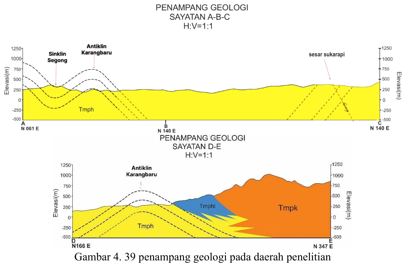
The geological cross-section is the project’s principal integration test because every contact, attitude, fold and fault must coexist geometrically beneath measured topography.
SOURCE-LED TECHNICAL READING
Geological interpretation and evidential boundary
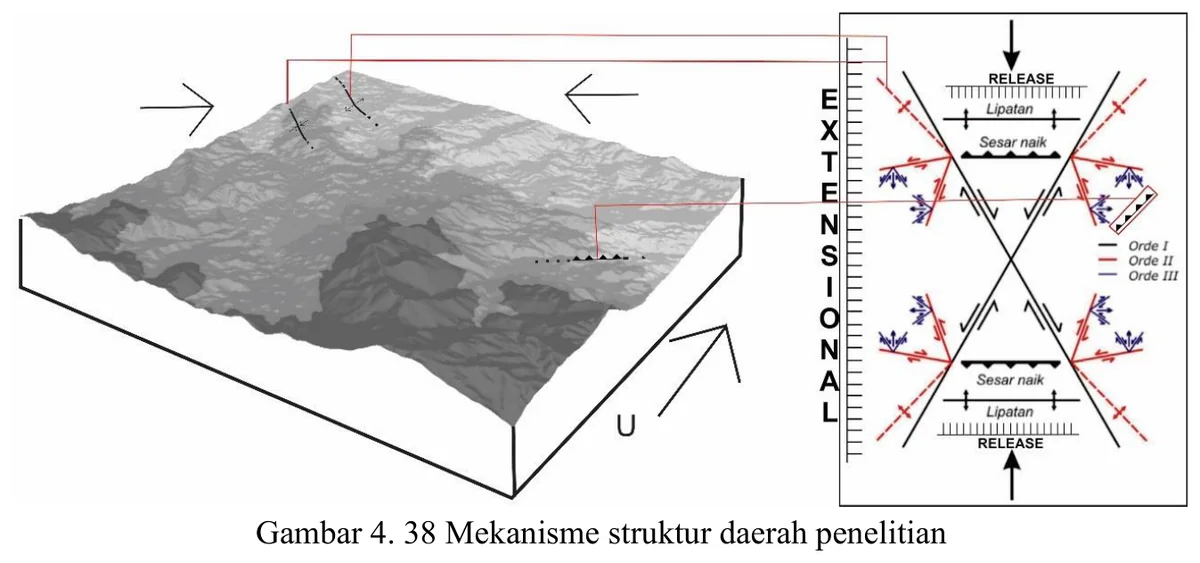
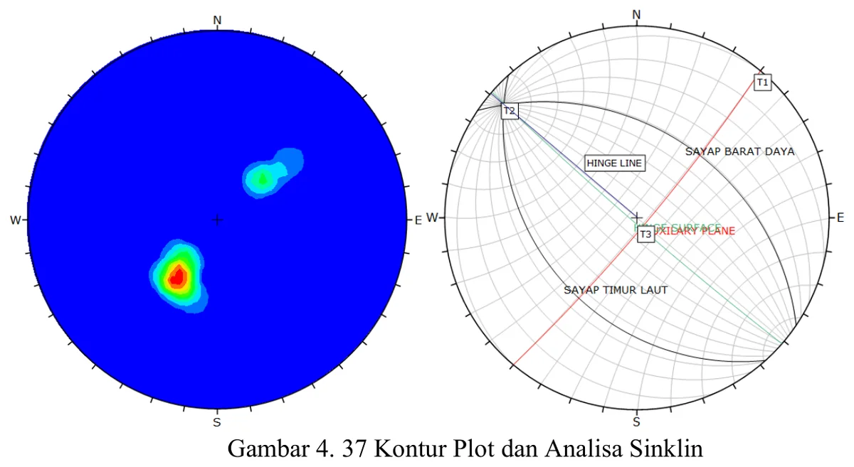
The geological cross-section is the project’s principal integration test because every contact, attitude, fold and fault must coexist geometrically beneath measured topography. Audit priorities are the exact section trace, projection distance of off-line data, conversion of apparent to true dip, thickness consistency, placement of inferred boundaries and whether fault offsets and fold limbs honour map patterns. Areas without control should be visibly distinguished from data-constrained geometry. A balanced or at least length-consistent reconstruction would add confidence, while alternative sections should be considered where subsurface data are absent. The section is therefore not a decorative summary: it is a falsifiable model that reveals contradictions among mapping, stereographic analysis and stratigraphic assumptions.
- Source
- Private mapping source vault · geological evidence record
- Location in source
- PDF page 85
- Image quality
- Source scan
- Record ID
- mapping-4-39