Geological Mapping · mapping-4-33
Lithostratigraphic framework
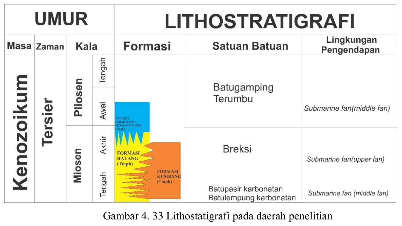
The lithostratigraphic framework is a synthesis of mapped units, fossil ages and inferred relationships, so it should visually separate observed contacts, inferred contacts, age constraints and regional correlation.
SOURCE-LED TECHNICAL READING
Geological interpretation and evidential boundary
The lithostratigraphic framework is a synthesis of mapped units, fossil ages and inferred relationships, so it should visually separate observed contacts, inferred contacts, age constraints and regional correlation. Halang, Lebakwangi and Kumbang units may exhibit lateral interfingering, diachronous boundaries or structural juxtaposition; arranging them as a simple vertical stack can imply superposition not demonstrated in the field. The framework should be tested against contact exposures, younging directions, cross-section geometry and fossil intervals with their uncertainties. Its scientific value is integrative rather than evidential: it is the current model that must explain all observations while remaining revisable where control is sparse. Alternative correlation scenarios should be retained if the data do not discriminate them.
- Source
- Private mapping source vault · geological evidence record
- Location in source
- PDF page 79
- Image quality
- Source scan
- Record ID
- mapping-4-33