Geological Mapping · mapping-4-3
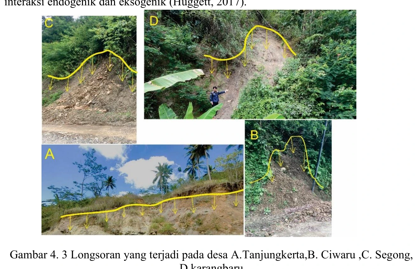
Documented landslide localities
The landslide montage confirms that slope failure occurred at several mapped localities and provides valuable scale, material and morphological context, yet photographs alone cannot establish a regional causal mechanism.
SOURCE-LED TECHNICAL READING
Geological interpretation and evidential boundary
The landslide montage confirms that slope failure occurred at several mapped localities and provides valuable scale, material and morphological context, yet photographs alone cannot establish a regional causal mechanism. Each site should be indexed to coordinates withheld from the public view, date, failure type, estimated dimensions, scarp and toe morphology, weathering profile, antecedent rainfall and any anthropogenic cut or drainage modification. The images can then be compared against slope class, lithology and structural fabric to separate translational failure along bedding or joints from rotational, debris-flow or shallow soil processes. Without that event-level metadata, the strongest conclusion is occurrence verification; susceptibility, recurrence and hazard zoning remain hypotheses requiring systematic inventory and temporal evidence.
- Source
- Private mapping source vault · geological evidence record
- Location in source
- PDF page 57
- Image quality
- Source scan
- Record ID
- mapping-4-3