Geological Mapping · mapping-4-4
River segmentation
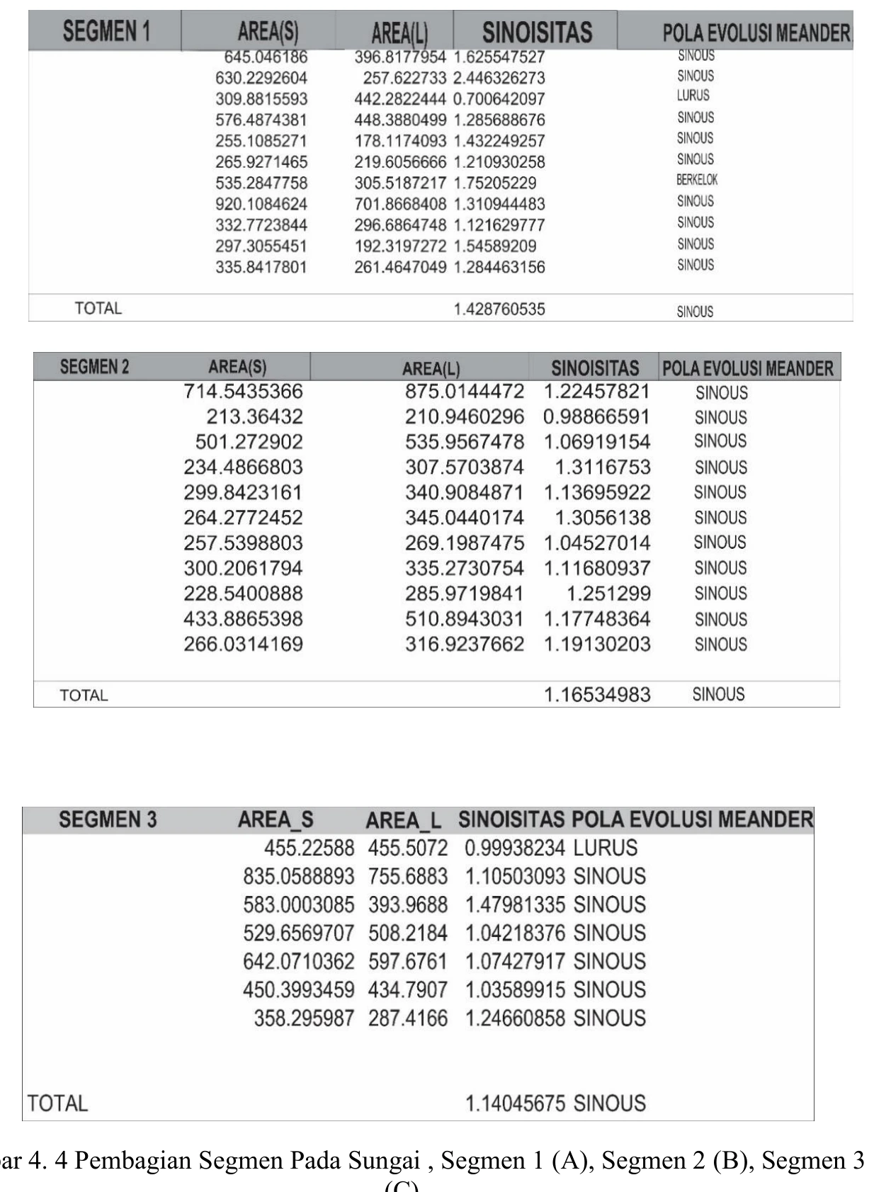
The river segmentation is useful if the reaches were divided by reproducible changes in gradient, confinement, sinuosity, substrate, tributary junctions or valley-floor width rather than by visual convenience.
SOURCE-LED TECHNICAL READING
Geological interpretation and evidential boundary
The river segmentation is useful if the reaches were divided by reproducible changes in gradient, confinement, sinuosity, substrate, tributary junctions or valley-floor width rather than by visual convenience. A process-based reading would test whether knickpoints or abrupt planform changes align with resistant units, mapped structures or base-level transitions, while recognising that discharge, sediment load and human channel modification can produce similar geometry. Segment length and boundary criteria should be tabulated, and channel metrics should be measured from a consistent imagery date and scale. The figure therefore functions as a sampling framework for longitudinal comparison; it does not, by itself, demonstrate tectonic control or a specific stage of landscape evolution.
- Source
- Private mapping source vault · geological evidence record
- Location in source
- PDF page 59
- Image quality
- Source scan
- Record ID
- mapping-4-4