Geological Mapping · mapping-4-1
Geomorphology base map
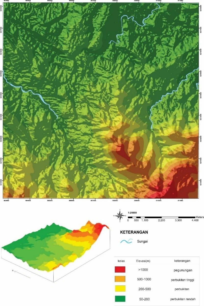
The elevation model establishes the first-order physiographic boundary conditions of the 81 km² survey, but elevation alone cannot discriminate lithology or structure.
SOURCE-LED TECHNICAL READING
Geological interpretation and evidential boundary
The elevation model establishes the first-order physiographic boundary conditions of the 81 km² survey, but elevation alone cannot discriminate lithology or structure. The defensible interpretation is therefore relational: compare ridge continuity, valley spacing and break-of-slope geometry with mapped contacts, measured attitudes and field stations, then test whether relief persists after normalising for drainage position. Before quantitative reuse, the DEM source, vertical datum, horizontal CRS, cell size, resampling method and contour interval should be reported; otherwise apparent lineaments may be raster artefacts. Its principal value is as a spatial hypothesis generator and topographic control for subsequent geomorphic, structural and access analysis, not as independent proof of formation boundaries.
- Source
- Private mapping source vault · geological evidence record
- Location in source
- PDF page 55
- Image quality
- Native PDF figure extraction
- Record ID
- mapping-4-1