Geological Mapping · mapping-4-23
Depositional-depth interpretation for LP21
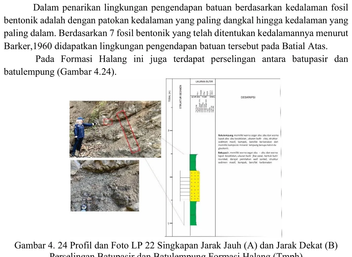
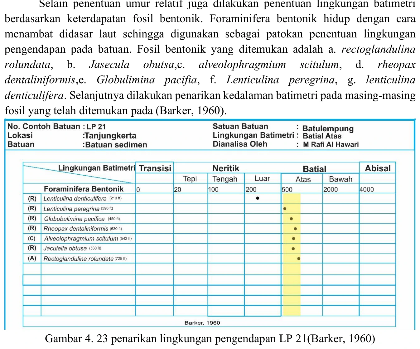
The LP21 depth chart reportedly places the sample in an upper-bathyal envelope, a plausible setting for fine-grained deposits associated with the Halang deep-water system. That conclusion remains conditional on the ecological calibration and preservation of the controlling benthic taxa.
SOURCE-LED TECHNICAL READING
Geological interpretation and evidential boundary
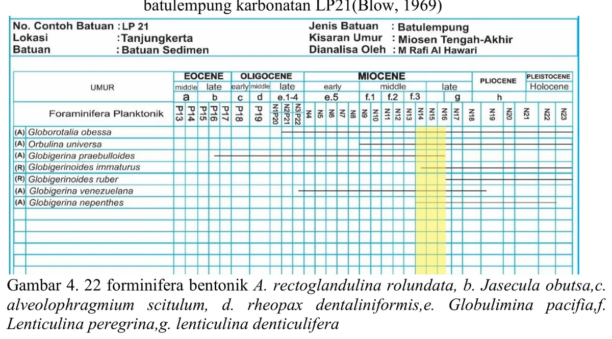
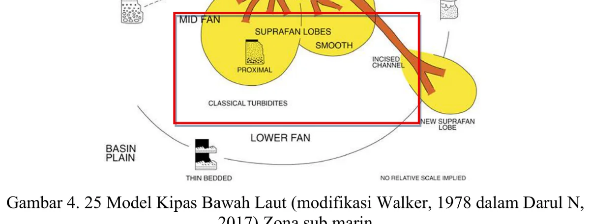
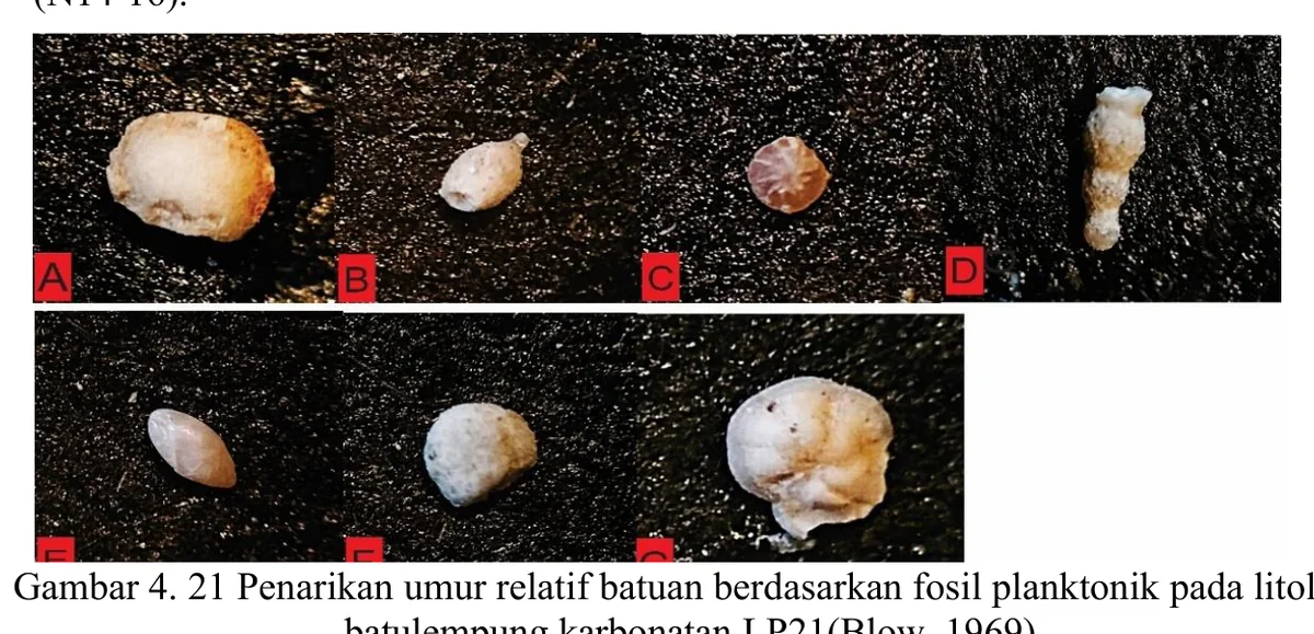
The LP21 depth chart reportedly places the sample in an upper-bathyal envelope, a plausible setting for fine-grained deposits associated with the Halang deep-water system. That conclusion remains conditional on the ecological calibration and preservation of the controlling benthic taxa. A transparent audit should show the intersection before rounding, identify taxa with the narrowest ranges, and repeat the calculation after removing potential shallow-water reworked forms. Sedimentological consistency is required: basin-plain or overbank mudstone architecture would support the interpretation, whereas wave structures, shallow benthos or subaerial features would contradict it. The appropriate output is a bathymetric class with uncertainty, not a precise metre range presented as directly measured depth.
- Source
- Private mapping source vault · geological evidence record
- Location in source
- PDF page 72
- Image quality
- Standard
- Record ID
- mapping-4-23