Geological Mapping · mapping-4-17
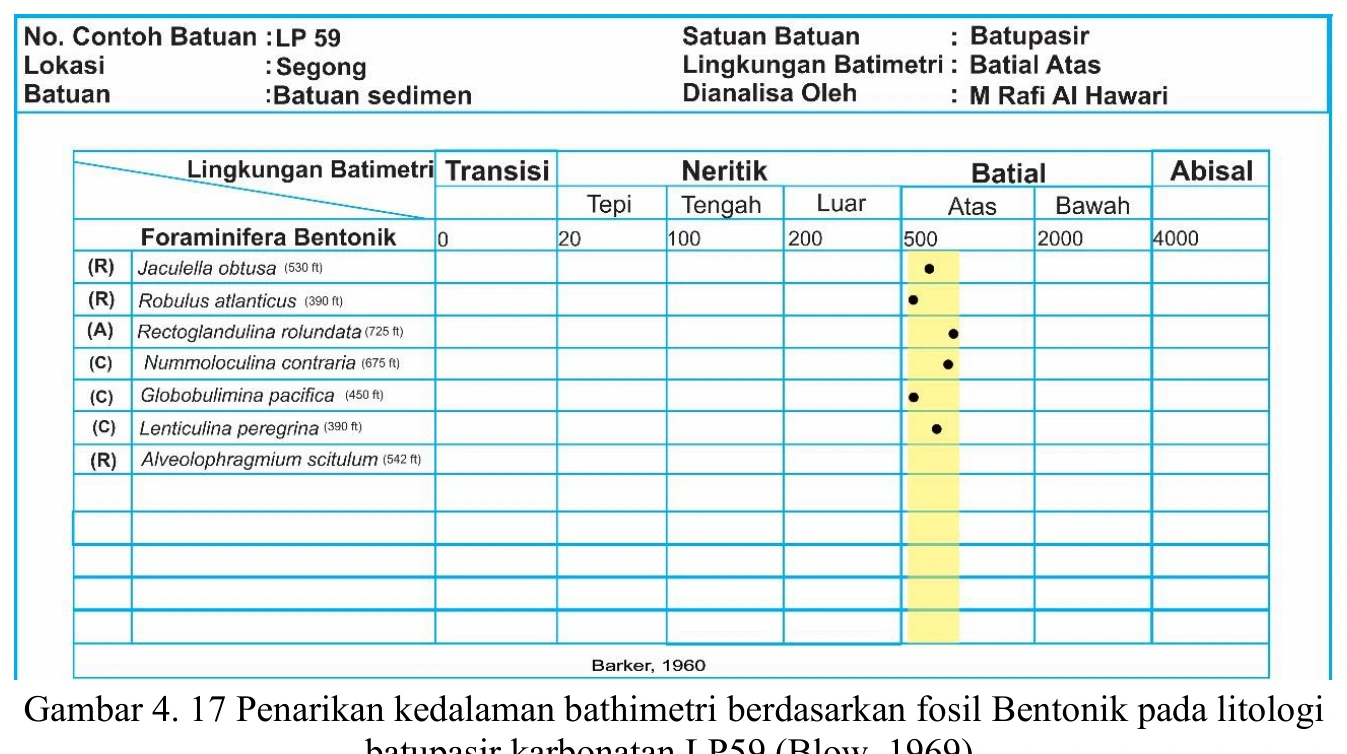
Palaeobathymetric range chart for LP59
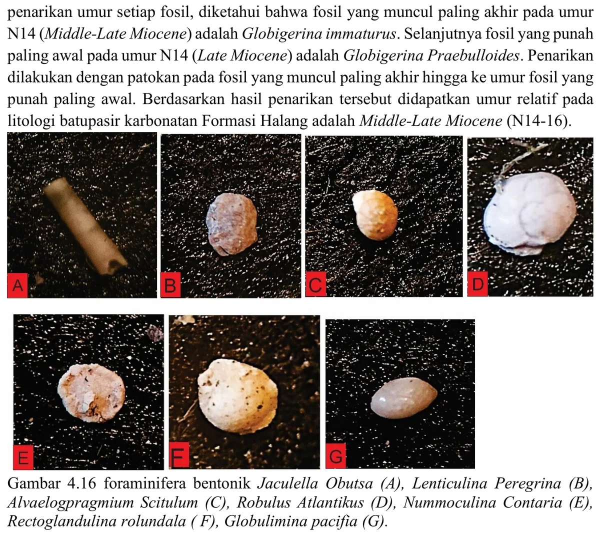
The palaeobathymetric chart synthesises ecological ranges for LP59 and is useful as an auditable bridge between taxonomy and environmental interpretation. Its endpoints should not be read as exact depositional depths because published ranges overlap broadly and respond to oxygen, productivity and substrate as well as depth.
SOURCE-LED TECHNICAL READING
Geological interpretation and evidential boundary
The palaeobathymetric chart synthesises ecological ranges for LP59 and is useful as an auditable bridge between taxonomy and environmental interpretation. Its endpoints should not be read as exact depositional depths because published ranges overlap broadly and respond to oxygen, productivity and substrate as well as depth. The analysis should identify which taxa actually define the envelope, whether those specimens are abundant and well preserved, and how reworking was screened. A sensitivity test that removes each controlling taxon in turn would reveal whether the conclusion is robust or dependent on one identification. The preferred result is therefore a stated depth zone with uncertainty and competing transport explanation, integrated with independent sedimentological evidence.
- Source
- Private mapping source vault · geological evidence record
- Location in source
- PDF page 69
- Image quality
- Standard
- Record ID
- mapping-4-17