Geological Mapping · mapping-4-15
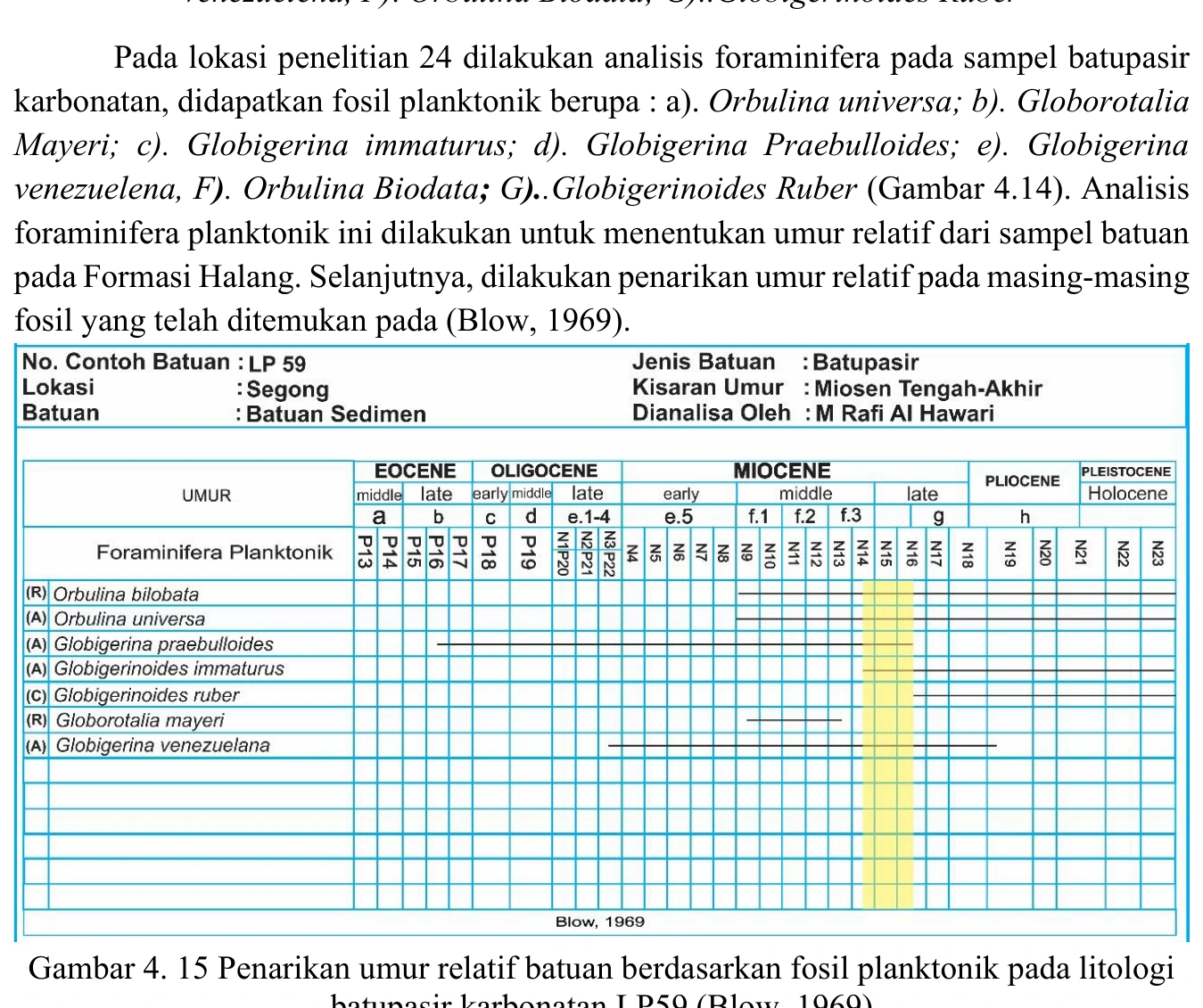
Planktonic range chart for LP59
The LP59 range chart is an interpretive calculation rather than new fossil evidence: its reliability cannot exceed the underlying identifications, taxonomic ranges and chosen zonation. Range overlap should document the reference calibration, regional applicability, treatment of uncertain taxa and whether datums represent global, tropical or local bioevents.
SOURCE-LED TECHNICAL READING
Geological interpretation and evidential boundary
The LP59 range chart is an interpretive calculation rather than new fossil evidence: its reliability cannot exceed the underlying identifications, taxonomic ranges and chosen zonation. Range overlap should document the reference calibration, regional applicability, treatment of uncertain taxa and whether datums represent global, tropical or local bioevents. Reworking biases the result older, while caving or contamination can bias it younger; both must be considered in a gravity-flow setting. The chart is strongest when a short interval is supported by several independent, well-preserved taxa and repeated in adjacent stratigraphic samples. A single visually neat overlap should not be converted into false temporal precision without those controls.
- Source
- Private mapping source vault · geological evidence record
- Location in source
- PDF page 67
- Image quality
- Standard
- Record ID
- mapping-4-15