Geological Mapping · mapping-4-10
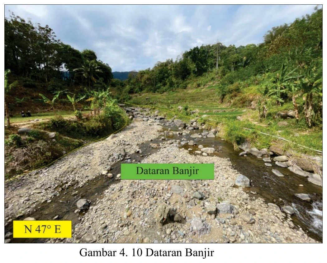
Floodplain landform
The low-relief surface adjacent to the active channel is compatible with a floodplain, although a single oblique image cannot distinguish active floodplain from a slightly elevated terrace, abandoned channel belt or anthropogenic surface.
SOURCE-LED TECHNICAL READING
Geological interpretation and evidential boundary
The low-relief surface adjacent to the active channel is compatible with a floodplain, although a single oblique image cannot distinguish active floodplain from a slightly elevated terrace, abandoned channel belt or anthropogenic surface. Elevation above bankfull stage, sediment texture and stratification, soil development, inundation history, channel scars and lateral continuity should be documented. The distinction matters because an active floodplain constrains present sediment transfer, whereas a terrace records an earlier base level and may preserve neotectonic or climatic information. This plate is therefore a geomorphic field observation whose classification should be supported by surveyed relative height and sedimentology; until then, the safest inference is a recent alluvial surface of uncertain activity.
- Source
- Private mapping source vault · geological evidence record
- Location in source
- PDF page 64
- Image quality
- Standard
- Record ID
- mapping-4-10