Mapping & Petrography Appendices · appendix-07
Final Geomorphological Map — Sheet 07
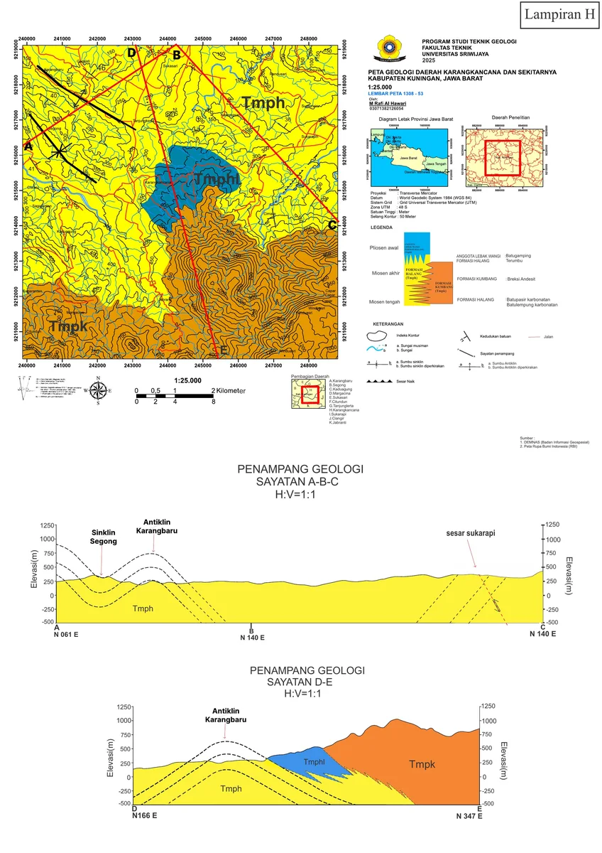
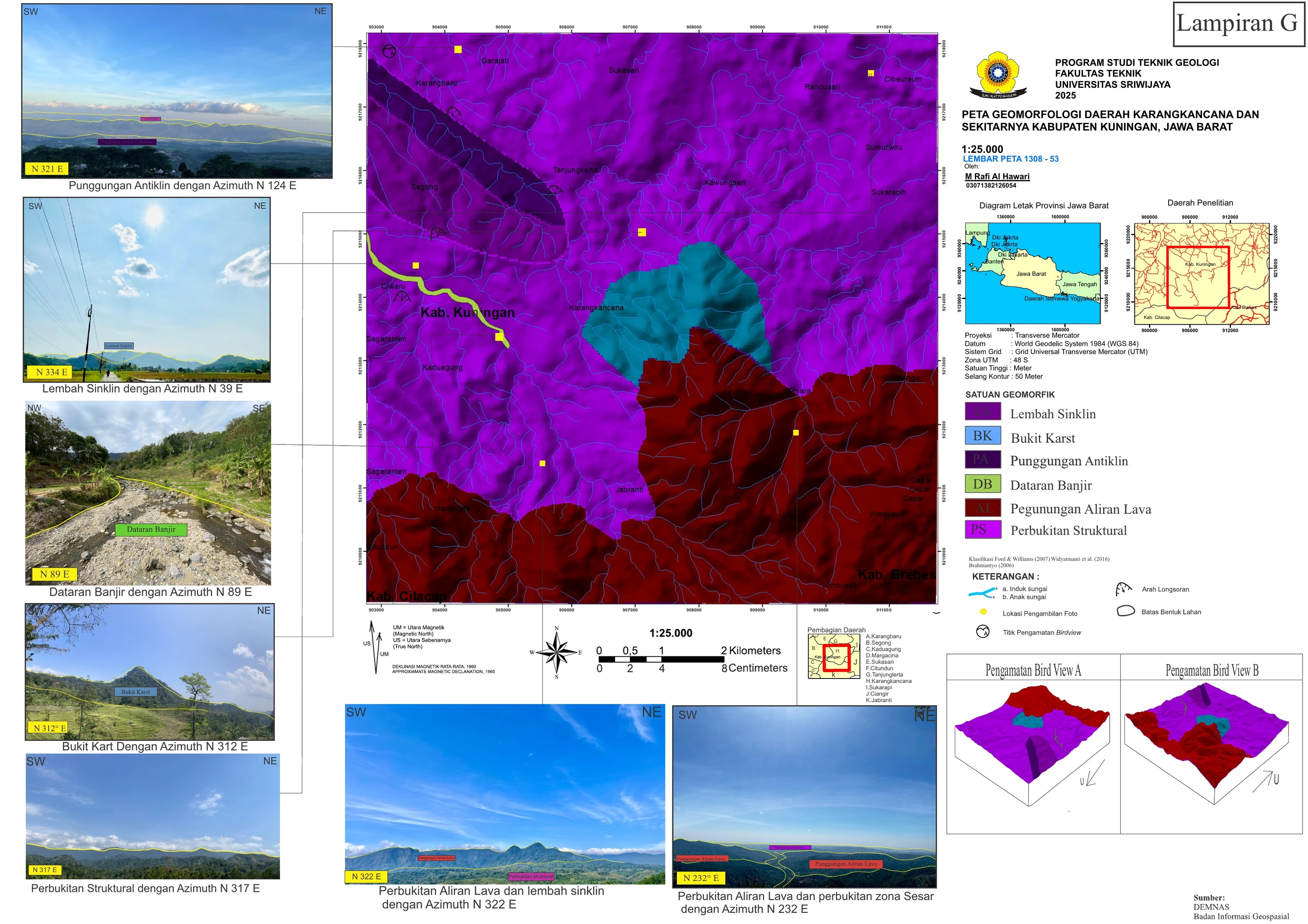
The geomorphological compilation combines terrain classes, field photographs, regional position and conceptual block views. Its principal strength is multi-scale traceability: mapped landforms can be compared with what was actually observed on the ground.
SOURCE-LED TECHNICAL READING
Geological interpretation and evidential boundary
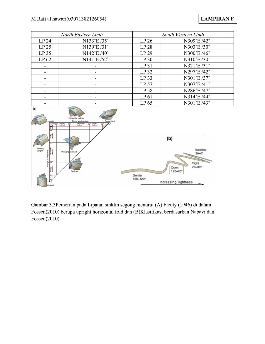
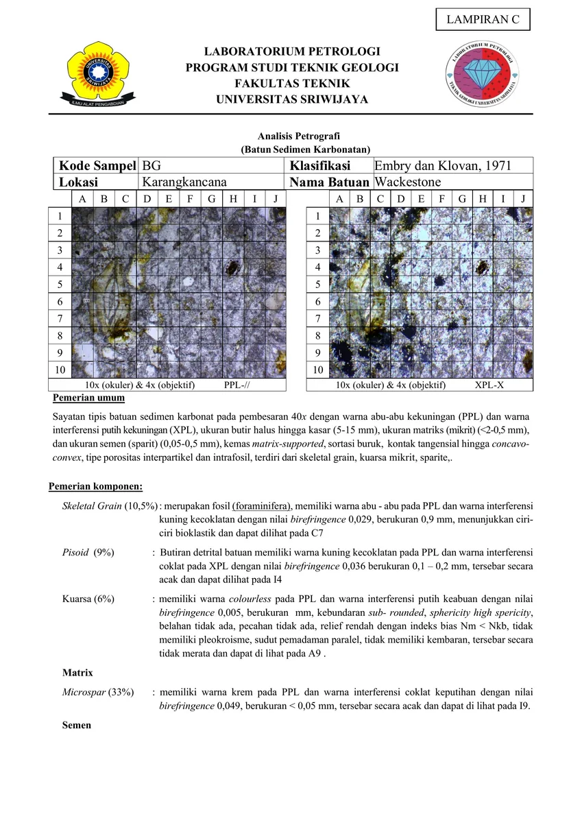
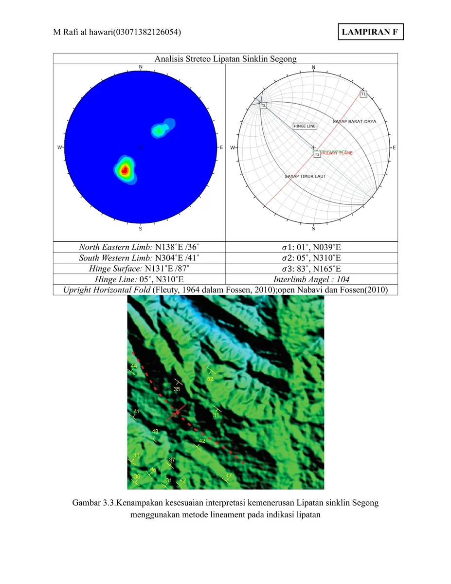
The geomorphological compilation combines terrain classes, field photographs, regional position and conceptual block views. Its principal strength is multi-scale traceability: mapped landforms can be compared with what was actually observed on the ground. The analytical hierarchy should remain explicit—DEM-derived morphology is observation, process assignment is interpretation, and structural or lithologic control is a hypothesis tested by independent mapping. Unit boundaries need reproducible criteria and transitions should be shown where form is gradual. Relief, slope, drainage and material data should be evaluated together, while photographic localities and exposure density reveal where confidence varies. This prevents visually attractive landform polygons from acquiring unjustified genetic certainty.
- Source
- Private geological appendix archive · controlled source record
- Location in source
- Source-linked record
- Image quality
- HD
- Record ID
- appendix-07